Varst Mapping & Property Reports
West Australian custom mapping solutions designed just for you
Get Started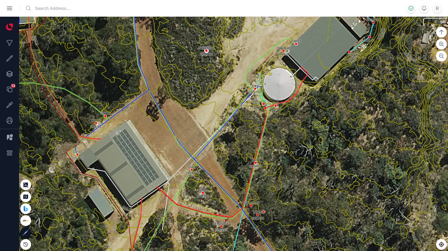

Meet Varst
Varst is your all-in-one solution for spatial insights and mapping in Western Australia. With innovative mapping tools and a rich data library, Varst enables businesses to create projects, customize layers, and gain valuable insights tailored to your unique requirements.
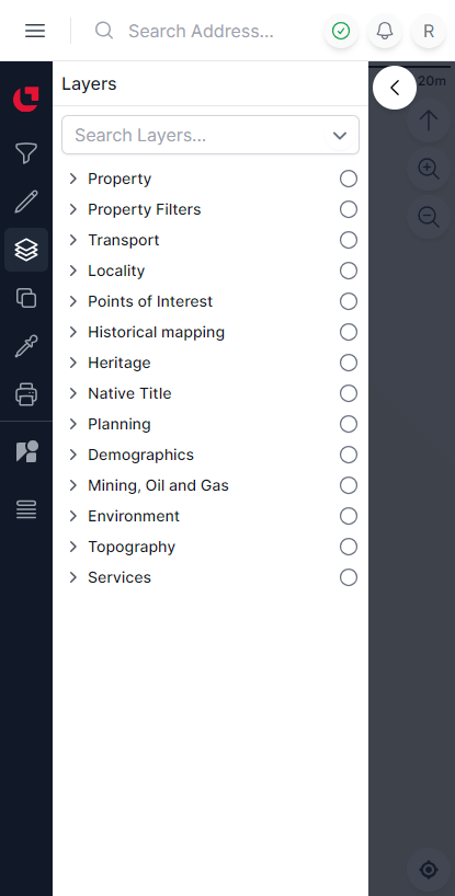
Huge Catalogue of Spatial Layers
Varst's extensive layer catalogue covers crucial spatial data, encompassing Demographics, Environment, Heritage, Planning, Property, Services, Topography, and Transport layers. The Property Layers provide a comprehensive view, including:
- Lot Boundaries
- Annotations
- Easements/Interests
- Strata Lots
- Crown Leases
- Pastoral Leases
- Pending Lots
- Government Tenure
Planning Layers offer insights into land-use planning crucial for urban development and zoning analysis.
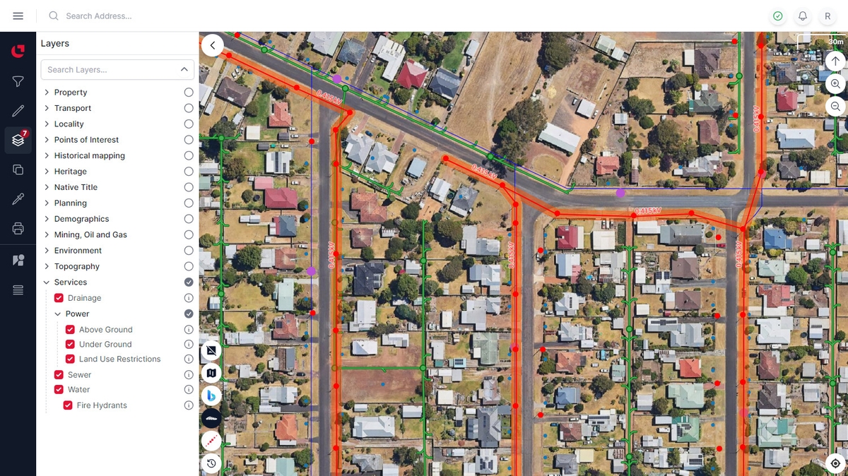
Service Layers
Service Layers provide critical information on utilities, including Power, Water, Sewer, and Drainage, offering valuable insights into infrastructure planning and service provision.
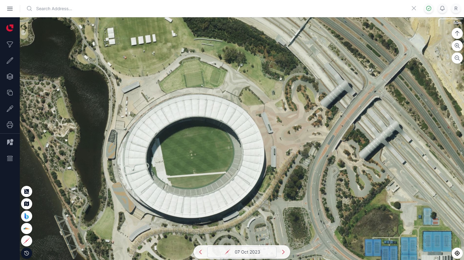
High Resolution Satellite Imagery
Varst's high-resolution imagery, sourced from providers like Landgate and MetroMap, is integral to its data offerings. The combination of Landgate's historical data and MetroMap's up-to-date captures ensures users access a dynamic visual dataset, empowering informed decisions in urban planning, environmental monitoring, and infrastructure development.
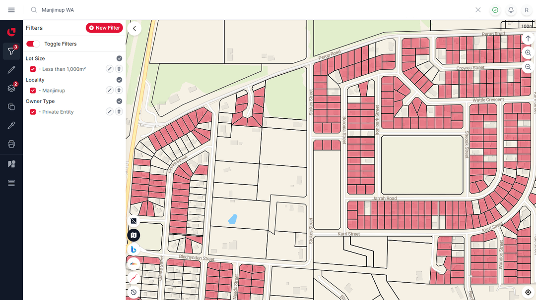
Property Filters
Varst's property filtering system empowers users with a robust tool set for refining property searches based on essential criteria, including Lot Size for precise land dimension specifications.
The filters range from Locality and Local Authority to MRS Zoning, Planning Scheme, Owner Type, Proprietor, Sale Price, and Sale Date, provide users with unparalleled flexibility to tailor searches to their specific criteria, enhancing efficiency in real estate and development inquiries.

Custom Layers
Varst Custom Layers lets you easily bring your own data and mix it in with our huge layer catalogue. Whether you're a company or an individual, it takes just seconds to export from popular CAD packages like AutoCAD or 12d Model and import directly into Varst. Use our user-friendly GUI to setup and organize layers into projects, then style them exactly the way you want.
Property Reports
Varst's Property Reports provide users with a comprehensive overview, incorporating a Property Overview section with a map, latest imagery, lot boundary, and dimensions. The report's Property Details section includes crucial information such as Lot Number, Street Address, Land Area, Locality, Local Authority, Certificate of Title, MRS Scheme, and R Code, while Sales History documents price trends and ownership changes.
The Topography section features a contour map, and Services details include power, water, drainage, and sewer connections. Public Transport information enhances the report's holistic overview, facilitating informed decision-making in real estate and development scenarios. Varst's Property Reports thus equip users with a detailed snapshot of property specifics, contributing to a comprehensive understanding.

Augmented Reality
Varst's AR Mode makes your mobile device location-aware, seamlessly integrating its position and orientation with the Varst map display. This practical feature allows you to view various layers, including your custom datasets, in real-world contexts, making it especially useful for on-site visits.
Whether you're examining a construction site or assessing urban planning scenarios, Varst's AR Mode offers a straightforward and interactive tool to overlay spatial data onto the physical environment, simplifying the decision-making process during site inspections and planning tasks.
What Clients are Saying
“Varst provides a more detailed engineering/construction focused aerial mapping tool that improves our due diligence and offsite planning. It has offered our company great efficiencies in tendering, project planning and problem solving.”
“Varst is the aerial imaging solution our company needed. The advanced modular custom layers with easy user interface has increased our service ability to clients in real time. Customer experience, exceptional. Customer service, outstanding”
“I have been using Varst for the last 6 months and have found the data invaluable when assessing properties for my commercial clients. It brings all of the required data together in one place.”
“Varst mapping solutions WA has been a game-changer for me as an electrician. Their easy-to-use mapping service has made quoting new work a breeze. I can effortlessly locate power facilities, check grid voltages, and even map line diagrams for new connections, all from the comfort of my office. The added bonus of StreetView has saved me countless trips to the site. I highly recommend Varst to any fellow electricians looking for a reliable and efficient mapping solution. It's been a real time-saver for me!”